Import a GPX file

Mastodon Peak

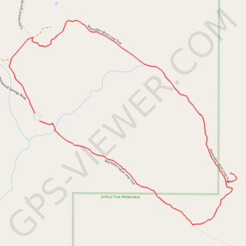
Loop hike to Mastodon Peak on the Mastodon Mine Loop Trail in the Joshua Tree National Park. #Hke #Loop #Mountain #Nature #Park #Desert

  • Distance: 3.9 Km
  • Elevation gain: 120 m
  • Maximum elevation: 1,025 m
  • Elevation loss: 117 m
  • Minimum elevation: 908 m

Interactive trail map

Trail profile

  • Distance: 3.9 Km
  • Elevation gain: 120 m
  • Maximum elevation: 1,025 m
  • Elevation loss: 117 m
  • Minimum elevation: 908 m

About this trail
Gear up for your next adventure:

🧢Waterproof Caps - Keep rain off your face and glasses while hiking
🔗Locking Carabiners - Secure gear to your pack or for light climbing
🧣Multi-functional Neckwear - Protect against wind and sun with versatile Buffs
🎒Waterproof Backpacks - Protect your gear from rain on Irish hikes
📱Rugged Smartphones - Waterproof phones with long battery for offline mapping

As an Amazon Associate, this site earns from qualifying purchases at no extra cost to you.