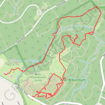
Tyler Arboretum
- Distance: 7.1 Km
- Elevation gain: 106 m
- Maximum elevation: 120 m
- Elevation loss: 108 m
- Minimum elevation: 74 m
- Moving time: 1 h 55 m
- Moving speed: 3.7 Km/h
- Maximum speed: 7.2 Km/h
- Total time: 1 h 57 m
- Global speed: 3.6 Km/h
Interactive trail map
Trail profile
- Distance: 7.1 Km
- Elevation gain: 106 m
- Maximum elevation: 120 m
- Elevation loss: 108 m
- Minimum elevation: 74 m
- Moving time: 1 h 55 m
- Moving speed: 3.7 Km/h
- Maximum speed: 7.2 Km/h
- Total time: 1 h 57 m
- Global speed: 3.6 Km/h
About this trail
Name: Tyler Arboretum trail, distance, elevation, map, profile, GPS track
Coordinates: 39.93136 -75.44190 39.94401 -75.42446