Import a GPX file

Amherst Point Bird Sanctuary

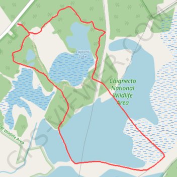
Chignecto National Wildlife Area. #Hiking #Loop #Lake #Forest #Chignecto

  • Distance: 4.6 Km
  • Elevation gain: 46 m
  • Maximum elevation: 30 m
  • Elevation loss: 46 m
  • Minimum elevation: 2 m

Interactive trail map

Trail profile

  • Distance: 4.6 Km
  • Elevation gain: 46 m
  • Maximum elevation: 30 m
  • Elevation loss: 46 m
  • Minimum elevation: 2 m

About this trail
Gear up for your next adventure:

🔨Multi-tool Devices - Versatile tools for gear repairs in the field
🧗Rock Climbing Gear - Essentials for the cliffs of Moher or Gap of Dunloe
🔥Camping Stoves - Portable camping stoves for outdoor cooking
🧯Portable Extinguishers - Safety tools for campfires
🧯Campfire Safety Gear - Gear to safely manage fires

As an Amazon Associate, this site earns from qualifying purchases at no extra cost to you.