
Walk up A'Bhuidheanach Bheag
- Distance: 10.6 Km
- Elevation gain: 501 m
- Maximum elevation: 936 m
- Elevation loss: 503 m
- Minimum elevation: 444 m
- Moving time: 2 h 38 m
- Moving speed: 4.0 Km/h
- Maximum speed: 10.0 Km/h
- Total time: 4 h 2 s
- Global speed: 2.6 Km/h
Interactive trail map
Trail profile
- Distance: 10.6 Km
- Elevation gain: 501 m
- Maximum elevation: 936 m
- Elevation loss: 503 m
- Minimum elevation: 444 m
- Moving time: 2 h 38 m
- Moving speed: 4.0 Km/h
- Maximum speed: 10.0 Km/h
- Total time: 4 h 2 s
- Global speed: 2.6 Km/h
About this trail
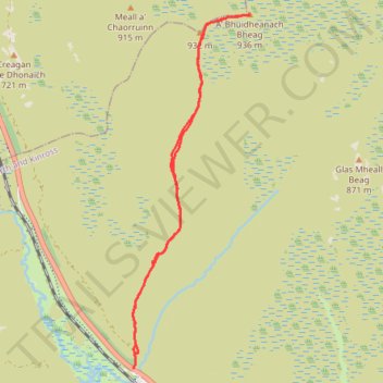
Name: Walk up A'Bhuidheanach Bheag trail, distance, elevation, map, profile, GPS track
Start: A9, Dalnaspidal, Perth and Kinross, Scotland, United Kingdom (56.83220 -4.22178)
End: A9, Dalnaspidal, Perth and Kinross, Scotland, United Kingdom (56.83203 -4.22184)
Coordinates: 56.83203 -4.22200 56.87048 -4.19879