Import a GPX file

Chiquito Falls (Lyon Canyon Falls)

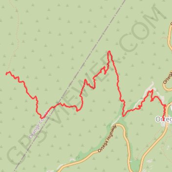
Hike to Chiquito Falls (or Lyon Canyon Falls) via San Juan Trail and Chiquito Trail in the Cleveland National Forest. #Hiking #Falls #Nature #Mountain #Forest #River

  • Distance: 7.0 Km
  • Elevation gain: 342 m
  • Maximum elevation: 808 m
  • Elevation loss: 211 m
  • Minimum elevation: 513 m

Interactive trail map

Trail profile

  • Distance: 7.0 Km
  • Elevation gain: 342 m
  • Maximum elevation: 808 m
  • Elevation loss: 211 m
  • Minimum elevation: 513 m

About this trail
Other hiking, mountain biking, running and outdoor activity trails

Click on a trail to view its statistics, map and profile.
Morgan Trail and Morrell Canyon

United States > California > Riverside County > Lake Elsinore

Hike from Ortega Oaks via the Bear Canyon, the Morgan Trail and the Morrell Canyon in the San Mateo Canyon Wilderness and the Cleveland National Forest. #Hiking #Nature #Canyon #Mountain #Forest #Wilderness

Distance: 8.4 Km • Elevation gain: 349 m • Maximum elevation: 888 m

Gear up for your next adventure:

🎒Day Packs - Perfect packs for day trips
⛺Camping Tents - Top tents for Irish weather and conditions
🧥Packable Down Jackets - High warmth-to-weight ratio for summit breaks
🪶Ultralight Tents - Lightweight shelters for hikers
🛸Lightweight Camera Drones - Capture stunning aerial topographic views of the landscape

As an Amazon Associate, this site earns from qualifying purchases at no extra cost to you.