Import a GPX file

Dove Valley

#Hiking #Loop

  • Distance: 10.8 Km
  • Elevation gain: 202 m
  • Maximum elevation: 318 m
  • Elevation loss: 202 m
  • Minimum elevation: 201 m

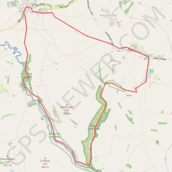
Interactive trail map

Trail profile

  • Distance: 10.8 Km
  • Elevation gain: 202 m
  • Maximum elevation: 318 m
  • Elevation loss: 202 m
  • Minimum elevation: 201 m

About this trail
Gear up for your next adventure:

🦯Lightweight Trekking Poles - Reduce knee strain on steep Wicklow or Kerry slopes
🔦Everyday Carry Torches - Reliable backup light for your hiking pack
🥘Camping Cookware Sets - Cookware sets for backpacking meals
💡Hiking Headlamps - Hands‑free lights for night hikes
🍁Eco‑Friendly Outdoor Products - Sustainable outdoor gear

As an Amazon Associate, this site earns from qualifying purchases at no extra cost to you.