
Mount Nebo and North Peak
Wolf Pass. Rocky Mountains. #Hiking #RockyMoutains
- Distance: 15.3 Km
- Elevation gain: 1,256 m
- Maximum elevation: 3,620 m
- Elevation loss: 1,254 m
- Minimum elevation: 2,819 m
Interactive trail map
Trail profile
- Distance: 15.3 Km
- Elevation gain: 1,256 m
- Maximum elevation: 3,620 m
- Elevation loss: 1,254 m
- Minimum elevation: 2,819 m
About this trail
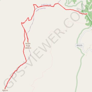
Name: Mount Nebo and North Peak trail, distance, elevation, map, profile, GPS track
Start: North Nebo Peak Trailhead, Forest Road 160, Utah County, Utah, United States (39.84842 -111.72190)
End: Forest Road 160, Utah County, Utah, United States (39.84862 -111.72241)
Coordinates: 39.82158 -111.76045 39.85228 -111.72188