Import a GPX file

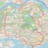
Chinatown - Singapore

#Hiking #Loop

  • Distance: 4.5 Km
  • Elevation gain: 72 m
  • Maximum elevation: 23 m
  • Elevation loss: 63 m
  • Minimum elevation: 1 m

Interactive trail map

Trail profile

  • Distance: 4.5 Km
  • Elevation gain: 72 m
  • Maximum elevation: 23 m
  • Elevation loss: 63 m
  • Minimum elevation: 1 m

About this trail

Other hiking, mountain biking, running and outdoor activity trails

Click on a trail to view its statistics, map and profile.

Singapore

Singapore > Singapore

#Hiking

Distance: 7.7 Km • Elevation gain: 121 m • Maximum elevation: 24 m

Singapore

Singapore > Singapore

#Hiking

Distance: 11.8 Km • Elevation gain: 139 m • Maximum elevation: 25 m

Singapore

Singapore > Singapore

#Hiking

Distance: 14.3 Km • Elevation gain: 214 m • Maximum elevation: 49 m

Directions from Duck Tour Ramp to Marina Boulevard, Singapore

Singapore > Singapore

Distance: 105.3 Km • Elevation gain: 812 m • Maximum elevation: 51 m

Singapore

Singapore > Singapore

Distance: 21.8 Km • Elevation gain: 402 m • Maximum elevation: 53 m

Singapore

Singapore > Singapore

https://en-hk.gps-viewer.com/track-181rr/Singapore/

Distance: 11.8 Km • Elevation gain: 141 m • Maximum elevation: 25 m

Gear up for your next adventure:

🔨Multi-tool Devices - Versatile tools for gear repairs in the field
🧺Quick-Dry Hiking Towels - Space-saving towels for wild swimming or camping
🌄Sun Protection Gear - Gear to shield from strong sun
🩻Outdoor Health Essentials - Necessary health items for hikes
🪶Down Jackets - Warm jackets for cold outdoor trips

As an Amazon Associate, this site earns from qualifying purchases at no extra cost to you.