Thank you for supporting this site ❤️
Make a donation
Make a donation
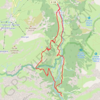
Day 4 Standard route at Gavarnie
- Distance: 10.1 Km
- Elevation gain: 495 m
- Maximum elevation: 1,707 m
- Elevation loss: 495 m
- Minimum elevation: 1,370 m
- Moving time: 4 h 38 m
- Moving speed: 2.2 Km/h
- Maximum speed: 7.1 Km/h
- Total time: 9 h 30 m
- Global speed: 1.1 Km/h
Interactive trail map
Thank you for supporting this site ❤️
Make a donation
Make a donation
Trail profile
- Distance: 10.1 Km
- Elevation gain: 495 m
- Maximum elevation: 1,707 m
- Elevation loss: 495 m
- Minimum elevation: 1,370 m
- Moving time: 4 h 38 m
- Moving speed: 2.2 Km/h
- Maximum speed: 7.1 Km/h
- Total time: 9 h 30 m
- Global speed: 1.1 Km/h
Thank you for supporting this site ❤️
Make a donation
Make a donation
About this trail
Name: Day 4 Standard route at Gavarnie trail, distance, elevation, map, profile, GPS track
Coordinates: 42.70419 -0.02003 42.73504 -0.00722
Thank you for supporting this site ❤️
Make a donation
Make a donation
Other hiking, mountain biking, running and outdoor activity trails
Click on a trail to view its statistics, map and profile.
GR 10 - Traversée des Pyrénées
France > Occitania > Pyrénées-Orientales > Banyuls-sur-Mer
Distance: 874.8 Km • Elevation gain: 57,000 m • Maximum elevation: 2,599 m
Day 4 Harder walking - Espugues path
France > Occitania > Hautes Pyrenees > Gavarnie-Gèdre > Gavarnie
Distance: 4.6 Km • Elevation gain: 354 m • Maximum elevation: 1,810 m
Southern section — European Divide Trail
France > Auvergne-Rhône-Alpes > Drôme > Valence
Distance: 2,423.8 Km • Elevation gain: 42,375 m • Maximum elevation: 2,005 m
1 LUCENA - MONTPELLIER
Distance: 2,964.4 Km • Elevation gain: 29,500 m • Maximum elevation: 1,048 m
Thank you for supporting this site ❤️
Make a donation
Make a donation