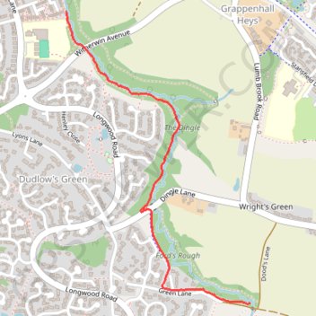
The Dingle
- Distance: 1.7 Km
- Elevation gain: 6 m
- Maximum elevation: 60 m
- Elevation loss: 31 m
- Minimum elevation: 31 m
- Moving time: 18 m 26 s
- Moving speed: 5.6 Km/h
- Maximum speed: 23.5 Km/h
- Total time: 18 m 26 s
- Global speed: 5.6 Km/h
Interactive trail map
Trail profile
- Distance: 1.7 Km
- Elevation gain: 6 m
- Maximum elevation: 60 m
- Elevation loss: 31 m
- Minimum elevation: 31 m
- Moving time: 18 m 26 s
- Moving speed: 5.6 Km/h
- Maximum speed: 23.5 Km/h
- Total time: 18 m 26 s
- Global speed: 5.6 Km/h
About this trail
Name: The Dingle trail, distance, elevation, map, profile, GPS track
Coordinates: 53.35384 -2.56746 53.36356 -2.55720