
2026-10-30 18:17:38
- Distance: 3.0 Km
- Elevation gain: 18 m
- Maximum elevation: 240 m
- Elevation loss: 16 m
- Minimum elevation: 227 m
- Moving time: 17 m 29 s
- Moving speed: 10.3 Km/h
- Maximum speed: 15.2 Km/h
- Total time: 17 m 29 s
- Global speed: 10.3 Km/h
Interactive trail map
Trail profile
- Distance: 3.0 Km
- Elevation gain: 18 m
- Maximum elevation: 240 m
- Elevation loss: 16 m
- Minimum elevation: 227 m
- Moving time: 17 m 29 s
- Moving speed: 10.3 Km/h
- Maximum speed: 15.2 Km/h
- Total time: 17 m 29 s
- Global speed: 10.3 Km/h
About this trail
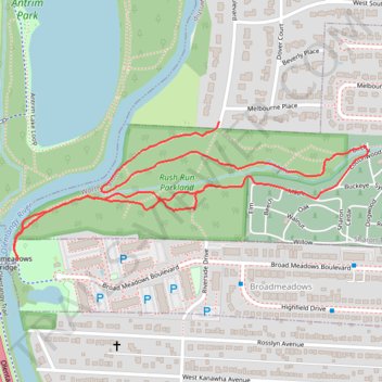
Name: 2026-10-30 18:17:38 trail, distance, elevation, map, profile, GPS track
Start: Elm, Worthington, Sharon Township, Franklin County, Ohio, 43085, United States (40.07600 -83.02868)
Coordinates: 40.07427 -83.03468 40.07750 -83.02396
Other hiking, mountain biking, running and outdoor activity trails
Click on a trail to view its statistics, map and profile.

ThrottleCo_River_Roads_Loop
United States > Ohio > Franklin County > Columbus
Distance: 106.6 Km • Elevation gain: 413 m • Maximum elevation: 300 m