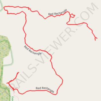
Meetinghouse Pond Red Rectangle Trail in Kensan-Devan Wildlife Sanctuary
- Distance: 1.3 Km
- Elevation gain: 52 m
- Maximum elevation: 372 m
- Elevation loss: 26 m
- Minimum elevation: 337 m
- Moving time: 32 m 20 s
- Moving speed: 2.4 Km/h
- Maximum speed: 8.4 Km/h
- Total time: 47 m 41 s
- Global speed: 1.6 Km/h
Interactive trail map
Trail profile
- Distance: 1.3 Km
- Elevation gain: 52 m
- Maximum elevation: 372 m
- Elevation loss: 26 m
- Minimum elevation: 337 m
- Moving time: 32 m 20 s
- Moving speed: 2.4 Km/h
- Maximum speed: 8.4 Km/h
- Total time: 47 m 41 s
- Global speed: 1.6 Km/h
About this trail
Name: Meetinghouse Pond Red Rectangle Trail in Kensan-Devan Wildlife Sanctuary trail, distance, elevation, map, profile, GPS track
Coordinates: 42.88549 -72.17920 42.88811 -72.17542
Other hiking, mountain biking, running and outdoor activity trails
Click on a trail to view its statistics, map and profile.
Meetinghouse Pond Yellow Rectangle Trail in Kensan-Devan Wildlife Sanctuary
United States > New Hampshire > Cheshire County > Marlborough
Distance: 0.7 Km • Elevation gain: 18 m • Maximum elevation: 351 m