Import a GPX file

Mont Blanc par les Grands Mulets trails

Click on a trail to view its statistics, map and profile.
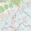
Mont Blanc par les Grands Mulets

France > Auvergne-Rhône-Alpes > Upper Savoy > Chamonix-Mont-Blanc > Les Bossons

Distance: 25.6 Km • Elevation gain: 3,832 m • Maximum elevation: 4,799 m

Gear up for your next adventure:

🚲Cycling GPS Computers - Topographic mapping for Irish road and mountain biking
🎿Skiing Gear - Winter sports essentials
🍖Freeze-Dried Trail Meals - Nutritious and lightweight food for expeditions
🗺️Topographic Maps - Detailed maps for hiking, cycling and planning routes
🧴Anti-Chafe Sticks - Prevent friction during long distance walking

As an Amazon Associate, this site earns from qualifying purchases at no extra cost to you.