Import a GPX file

Guntersville trails

Click on a trail to view its statistics, map and profile.
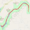
Town Creek - Lake Guntersville

United States > Alabama > Marshall County > Guntersville

Town Creek from Guntersville Lake to rocks - kayak, town creek, guntersville

Distance: 18.8 Km • Elevation gain: 142 m • Maximum elevation: 197 m

Gear up for your next adventure:

🕶️Polarized Sunglasses - Reduce glare outdoors
🔧Bicycle Repair Kits - On‑the‑go bike maintenance tools
🎒Fully Waterproof Rucksacks - Submersible protection for river crossings
📱Rugged Smartphones - Waterproof phones with long battery for offline mapping
🧥Packable Down Jackets - High warmth-to-weight ratio for summit breaks

As an Amazon Associate, this site earns from qualifying purchases at no extra cost to you.