Import a GPX file

Marshall County trails

Click on a trail to view its statistics, map and profile.
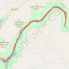
Town Creek - Lake Guntersville

United States > Alabama > Marshall County > Guntersville

Town Creek from Guntersville Lake to rocks - kayak, town creek, guntersville

Distance: 18.8 Km • Elevation gain: 142 m • Maximum elevation: 197 m
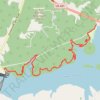
Honeycomb Trail Complete

United States > Alabama > Marshall County > Cottonville

Distance: 14.1 Km • Elevation gain: 443 m • Maximum elevation: 261 m

Other places

 •

Gear up for your next adventure:

⌚Solar Multisport Watches - Advanced mapping and GPS tracking for endurance hikers
🔨Multi-tool Devices - Versatile tools for gear repairs in the field
🧭Route Planning Books - Plan the best hiking routes
🔌Fast Car Chargers - Recharge GPS and phones between trailheads
🥾Hiking Boots - Top hiking boots for Irish trails and rugged terrain

As an Amazon Associate, this site earns from qualifying purchases at no extra cost to you.