Import a GPX file

Tuto trails

Click on a trail to view its statistics, map and profile.

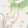
Pic du Montcalm - Étang d'Estats - Étang du Pinet - Étang Sourd

France > Occitania > Ariège > Auzat > Tuto

Distance: 18.9 Km • Elevation gain: 2,019 m • Maximum elevation: 3,065 m

Gear up for your next adventure:

🥾Waterproof Hiking Boots - Best waterproof boots for wet Irish weather
🥾Mountaineering Boots - Heavy‑duty boots for rugged peaks
🖊️All-Weather Pens - Pressurized ink cartridges that write upside down and in wet
📱Phone Holders for Biking - Secure phone mounts for touring cyclists
🏃Men's Trail Runners - Grip and speed for rugged Irish mountain running

As an Amazon Associate, this site earns from qualifying purchases at no extra cost to you.