Import a GPX file

Auzat trails

Click on a trail to view its statistics, map and profile.

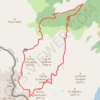
Pic du Montcalm - Étang d'Estats - Étang du Pinet - Étang Sourd

France > Occitania > Ariège > Auzat > Tuto

Distance: 18.9 Km • Elevation gain: 2,019 m • Maximum elevation: 3,065 m

Other places

Gear up for your next adventure:

📟Handheld Altimeters - Track elevation changes and weather patterns accurately
🪢Paracord & Ropes - Strong ropes for camping and gear
🧼Biodegradable Soaps - Eco‑friendly soap for backpacking
🔋Rechargeable Batteries - Eco-friendly power for headlamps and GPS units
👣Orthopedic Boot Insoles - Extra comfort for long distance walking

As an Amazon Associate, this site earns from qualifying purchases at no extra cost to you.