Import a GPX file

Westkirchen trails

Click on a trail to view its statistics, map and profile.
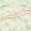
Fledermauswald

Germany > North Rhine-Westphalia > Kreis Warendorf > Ennigerloh > Westkirchen

Loop from Ennigerloh.

Distance: 49.9 Km • Elevation gain: 114 m • Maximum elevation: 83 m

Gear up for your next adventure:

🗺️Topographic Maps - Detailed maps for hiking, cycling and planning routes
🥾Men's Waterproof Boots - Sturdy footwear for wet and boggy Irish terrain
🥽UV Protection Sunglasses - Protect eyes on bright days
🧦Hiking Socks - Comfortable socks to prevent blisters
🔌Travel Adapters - Essential for visitors to charge gear in Ireland

As an Amazon Associate, this site earns from qualifying purchases at no extra cost to you.