Import a GPX file

Greenock trails

Click on a trail to view its statistics, map and profile.
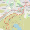
Dunrod Hill and Hillside Hill loop from Greenock West - Clyde Muirshiel Regional Park

United Kingdom > Scotland > Inverclyde > Greenock

Distance: 18.9 Km • Elevation gain: 410 m • Maximum elevation: 291 m

Gear up for your next adventure:

🛌Cold Weather Sleeping Bags - Warm sleeping bags for colder hikes
🛍️Outdoor Accessory Kits - Bundles for new hikers
🪓Camping Hand Axes - For processing wood during forest camping
👖Zip-off Hiking Pants - Adapt to changing Irish temperatures quickly
🚲Cycling GPS Computers - Topographic mapping for Irish road and mountain biking

As an Amazon Associate, this site earns from qualifying purchases at no extra cost to you.