
Verona trails
Click on a trail to view its statistics, map and profile.
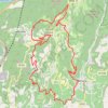
Copia di Giretto di controllo sul pastello
Italy > Veneto > Verona > Fumane
Distance: 24.4 Km • Elevation gain: 903 m • Maximum elevation: 755 m

2022_DE_Verona-Vicenza | flach
Italy > Veneto > Verona > Verona
Distance: 73.2 Km • Elevation gain: 471 m • Maximum elevation: 159 m

2022_DE_Peschiera-Verona
Italy > Veneto > Verona > Peschiera del Garda
Distance: 34.0 Km • Elevation gain: 278 m • Maximum elevation: 190 m