Import a GPX file

Aberglaslyn towards Cae Coch thwarted due to too much vegetation trails

Click on a trail to view its statistics, map and profile.
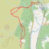
Aberglaslyn towards Cae Coch - thwarted due to too much vegetation

United Kingdom > Wales > Gwynedd > Nantmor

Gwynedd Walking

Distance: 7.9 Km • Elevation gain: 388 m • Maximum elevation: 214 m

Gear up for your next adventure:

🔌Fast Car Chargers - Recharge GPS and phones between trailheads
🔦Everyday Carry Torches - Reliable backup light for your hiking pack
🧶Camping String Lights - Ambience and utility lighting
🧥Waterproof Hiking Jackets - Rain jackets for unpredictable weather
🖼️Vintage Irish Map Prints - Decorative wall art for map lovers and geographers

As an Amazon Associate, this site earns from qualifying purchases at no extra cost to you.