Import a GPX file

Dinant trails

Click on a trail to view its statistics, map and profile.
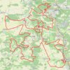
EPIC200 2021_100KM_edit7_6

Belgium > Namur > Dinant > Maredret > Maredsous

<p>De: RAVeL L150, Maredsous, Anhée, Namur, Wallonie<br/> À: RAVeL L150, Maredsous, Anhée, Namur, Wallonie</p> <p>Routage: Le plus court - OSM, Manuellement</p>

Distance: 101.5 Km • Elevation gain: 2,164 m • Maximum elevation: 268 m

Dinant - Maasdal - Verdun

Belgium > Namur > Dinant > Dinant

#Vélo #Ardennes

Distance: 238.6 Km • Elevation gain: 1,748 m • Maximum elevation: 226 m

Gear up for your next adventure:

🧂Electrolyte Tablets - Stay hydrated during strenuous mountain climbs
🚶‍♂️Trekking Poles - Supportive poles for stability on varied terrain
💨Windbreakers - Protection from strong winds
🧊Winter Boot Traction - Grip for icy paths in the Mourne or Derryveagh mountains
🔦UV Flashlights - Search for minerals or inspect maps at night

As an Amazon Associate, this site earns from qualifying purchases at no extra cost to you.