Import a GPX file

Dison trails

Click on a trail to view its statistics, map and profile.
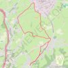
Ottomont - Andrimont - Mont Dison - Thimister - Andrimont - Ottomont

Belgium > Liège > Verviers > Dison > Andrimont

Monter jusqu'à l'église d'Andrimont, rejoindre Mont Dison par un chemin longeant les prairies. Rejoindre Thimister : Les Plenesses. Retour sur Andrimont via un chemin entre les prairies.

Distance: 9.9 Km • Elevation gain: 166 m • Maximum elevation: 295 m

Gear up for your next adventure:

🌄Sun Protection Gear - Gear to shield from strong sun
🪢Paracord & Ropes - Strong ropes for camping and gear
📸Travel Camera Tripods - Steady shots for landscape and long-exposure photos
🗺️Irish Road Atlases - Comprehensive physical maps for road trips and navigation
📈Fitness Trackers - Monitor activity and hike metrics

As an Amazon Associate, this site earns from qualifying purchases at no extra cost to you.