Import a GPX file

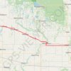
Russell - Shoal Lake

#Bike #Russell #Shoal

  • Distance: 77.6 Km
  • Elevation gain: 164 m
  • Maximum elevation: 599 m
  • Elevation loss: 167 m
  • Minimum elevation: 517 m

Interactive trail map

Trail profile

  • Distance: 77.6 Km
  • Elevation gain: 164 m
  • Maximum elevation: 599 m
  • Elevation loss: 167 m
  • Minimum elevation: 517 m

About this trail

Other hiking, mountain biking, running and outdoor activity trails

Click on a trail to view its statistics, map and profile.
Yorkton - Russell

Canada > Saskatchewan > Yorkton

#Bike #Yorkton #Russell

Distance: 105.1 Km • Elevation gain: 235 m • Maximum elevation: 565 m

Shoal Lake - Neepawa

Canada > Rural Municipality of Yellowhead > Shoal Lake

#Bike #Shoal #Neepawa

Distance: 96.6 Km • Elevation gain: 203 m • Maximum elevation: 609 m

Gear up for your next adventure:

🔥Compact Camping Stoves - Fast-boil stoves for trail-side meals and coffee
👖Zip-off Hiking Pants - Adapt to changing Irish temperatures quickly
🥾Lightweight Hiking Shoes - Light, breathable shoes for trail walking
🧿Weather Radios - Track weather in remote places
🥛Insulated Flasks - Keep drinks hot or cold

As an Amazon Associate, this site earns from qualifying purchases at no extra cost to you.