Import a GPX file

Kladovo Municipality trails

Click on a trail to view its statistics, map and profile.
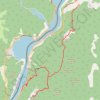
Miroč - Đerdap: Mali i Veliki Štrbac

Serbia > Central Serbia > Bor Administrative District > Kladovo Municipality > Tekija > Golo Brdo

Distance: 17.6 Km • Elevation gain: 766 m • Maximum elevation: 749 m

Other places

Gear up for your next adventure:

🍖High-Protein Trail Snacks - Lightweight fuel for long distance treks
🧺Collapsible Camp Bowls - Save space in your expedition kit
🧤Thermal Gloves - Warm gloves for cold weather
🧥Gore-Tex Rain Jackets - Breathable and fully waterproof shells for Irish weather
🌲Bushcraft Skills Books - Learn navigation, fire-making, and shelter building

As an Amazon Associate, this site earns from qualifying purchases at no extra cost to you.