Import a GPX file

Tekija trails

Click on a trail to view its statistics, map and profile.
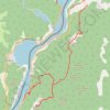
Miroč - Đerdap: Mali i Veliki Štrbac

Serbia > Central Serbia > Bor Administrative District > Kladovo Municipality > Tekija > Golo Brdo

Distance: 17.6 Km • Elevation gain: 766 m • Maximum elevation: 749 m

Other places

Gear up for your next adventure:

🧊Hydration Reservoirs - Easy drinking on the move with 2L or 3L bladders
🧯Portable Extinguishers - Safety tools for campfires
🧤Touchscreen Glove Liners - Use your mapping app without freezing your hands
🔌Fast Car Chargers - Recharge GPS and phones between trailheads
👣Waterproof Leg Gaiters - Keep bog water and debris out of your boots

As an Amazon Associate, this site earns from qualifying purchases at no extra cost to you.