Import a GPX file

Golo Brdo trails

Click on a trail to view its statistics, map and profile.
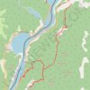
Miroč - Đerdap: Mali i Veliki Štrbac

Serbia > Central Serbia > Bor Administrative District > Kladovo Municipality > Tekija > Golo Brdo

Distance: 17.6 Km • Elevation gain: 766 m • Maximum elevation: 749 m

Gear up for your next adventure:

🧺Collapsible Camp Bowls - Save space in your expedition kit
🛶Inflatable Touring Kayaks - Explore Irish loughs and coastal topography
🧣Multi-functional Neckwear - Protect against wind and sun with versatile Buffs
Camping Tents - Top tents for Irish weather and conditions
🥾Lightweight Hiking Shoes - Light, breathable shoes for trail walking

As an Amazon Associate, this site earns from qualifying purchases at no extra cost to you.