Import a GPX file

Campbell County trails

Click on a trail to view its statistics, map and profile.
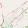
Cumberland Trail (CT) - Bruce Gap to Cumberland Mountain - Eagle Bluff

United States > Tennessee > Campbell County > Caryville

Distance: 14.3 Km • Elevation gain: 585 m • Maximum elevation: 645 m

Other places

Gear up for your next adventure:

🎒Technical Hiking Daypacks - Ergonomic backpacks with hydration bladder compatibility
📱Phone Holders for Biking - Secure phone mounts for touring cyclists
📚Irish Walking Guides - The best mapped trails in Wicklow, Kerry, and Connemara
🧺Quick-Dry Hiking Towels - Space-saving towels for wild swimming or camping
🍁Eco‑Friendly Outdoor Products - Sustainable outdoor gear

As an Amazon Associate, this site earns from qualifying purchases at no extra cost to you.