
Cumberland Trail (CT) - Bruce Gap to Cumberland Mountain - Eagle Bluff
- Distance: 14.3 Km
- Elevation gain: 585 m
- Maximum elevation: 645 m
- Elevation loss: 349 m
- Minimum elevation: 316 m
- Moving time: 4 h 53 m
- Moving speed: 2.9 Km/h
- Maximum speed: 7.0 Km/h
- Total time: 5 h 42 m
- Global speed: 2.5 Km/h
Interactive trail map
Trail profile
- Distance: 14.3 Km
- Elevation gain: 585 m
- Maximum elevation: 645 m
- Elevation loss: 349 m
- Minimum elevation: 316 m
- Moving time: 4 h 53 m
- Moving speed: 2.9 Km/h
- Maximum speed: 7.0 Km/h
- Total time: 5 h 42 m
- Global speed: 2.5 Km/h
About this trail
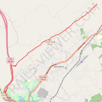
Name: Cumberland Trail (CT) - Bruce Gap to Cumberland Mountain - Eagle Bluff trail, distance, elevation, map, profile, GPS track
Coordinates: 36.30700 -84.23219 36.37536 -84.14948