Import a GPX file

Caryville trails

Click on a trail to view its statistics, map and profile.
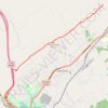
Cumberland Trail (CT) - Bruce Gap to Cumberland Mountain - Eagle Bluff

United States > Tennessee > Campbell County > Caryville

Distance: 14.3 Km • Elevation gain: 585 m • Maximum elevation: 645 m

Gear up for your next adventure:

🎧Wireless Earbuds - Music on the move
📖Outdoor Guide Books - Expert guides for Irish nature
🧥Waterproof Hiking Jackets - Rain jackets for unpredictable weather
🦯Lightweight Trekking Poles - Reduce knee strain on steep Wicklow or Kerry slopes
🥾Lightweight Hiking Shoes - Light, breathable shoes for trail walking

As an Amazon Associate, this site earns from qualifying purchases at no extra cost to you.