Import a GPX file

Grad Ivanec trails

Click on a trail to view its statistics, map and profile.
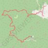
I retire. Farewell. Too long. Too dark. Too scary. Rain & pain. Never again. 🤣

Croatia > Varaždin County > Grad Ivanec > Prigorec

Distance: 23.4 Km • Elevation gain: 1,032 m • Maximum elevation: 1,049 m

Other places

Gear up for your next adventure:

🚲Cycling GPS Computers - Topographic mapping for Irish road and mountain biking
🧊Winter Boot Traction - Grip for icy paths in the Mourne or Derryveagh mountains
📻Emergency Crank Radios - Stay informed in remote areas without power
🥄Titanium Sporks - Indestructible and ultralight eating utensil
🎒Hiking Backpacks - Durable backpacks for day hikes and multi‑day treks

As an Amazon Associate, this site earns from qualifying purchases at no extra cost to you.