Import a GPX file

Prigorec trails

Click on a trail to view its statistics, map and profile.
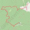
I retire. Farewell. Too long. Too dark. Too scary. Rain & pain. Never again. 🤣

Croatia > Varaždin County > Grad Ivanec > Prigorec

Distance: 23.4 Km • Elevation gain: 1,032 m • Maximum elevation: 1,049 m

Gear up for your next adventure:

🌲Bushcraft Skills Books - Learn navigation, fire-making, and shelter building
🌿Irish Flora Guides - Identify plants while exploring the countryside
🧯Campfire Safety Gear - Gear to safely manage fires
⌚Smart Watches for Hiking - Track performance on trails
🛶Inflatable Touring Kayaks - Explore Irish loughs and coastal topography

As an Amazon Associate, this site earns from qualifying purchases at no extra cost to you.