Import a GPX file

Varaždin County trails

Click on a trail to view its statistics, map and profile.
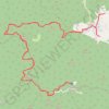
I retire. Farewell. Too long. Too dark. Too scary. Rain & pain. Never again. 🤣

Croatia > Varaždin County > Grad Ivanec > Prigorec

Distance: 23.4 Km • Elevation gain: 1,032 m • Maximum elevation: 1,049 m

Other places

Gear up for your next adventure:

🔋Lithium Batteries - Best performance for digital devices in cold weather
📟Handheld Altimeters - Track elevation changes and weather patterns accurately
🎁Outdoor Gift Ideas - Great gifts for adventurers
🛌Cold Weather Sleeping Bags - Warm sleeping bags for colder hikes
🔋Portable Power Banks - Keep devices charged on long trips

As an Amazon Associate, this site earns from qualifying purchases at no extra cost to you.