
Path trails
Click on a trail to view its statistics, map and profile.

Lower Yosemite Fall and Cook's Meadow Trails Loop
United States > California > Mariposa County > Yosemite Village > Yosemite Lodge
Starting near Yosemite Valley Lodge, the route enters the Lower Yosemite Fall Trail, follows Yosemite Creek through shaded valley woodland, and reaches the footbridge and close viewpoint beneath Lower Yosemite Fall. It then returns toward Northside Drive and crosses into Cook’s Meadow, where open meadow…
Distance: 3.3 Km • Elevation gain: 75 m • Maximum elevation: 1,252 m

Bull Hill Short Loop via Undercliff Trail in Hudson Highlands State Park Preserve
United States > New York > Putnam County
The Bull Hill Short Loop via the Undercliff Trail in Hudson Highlands State Park Preserve offers hikers captivating vistas of the Hudson River, with clear views of Storm King Mountain and Breakneck Ridge. Along the trail, remnants of the historic Cornish Estate provide a glimpse into the area's past. The path…
Distance: 7.1 Km • Elevation gain: 374 m • Maximum elevation: 338 m

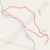
Friends Loop Trail in Beavers Bend State Park
United States > Oklahoma > McCurtain County > Stephens Gap
The Friends Trail Loop in Beavers Bend State Park offers hikers a diverse experience, beginning with a steep ascent through dense forests, leading to panoramic views of the Mountain Fork River. As the trail descends, it meanders along the riverbank, providing opportunities to observe unique rock formations and…
Distance: 2.4 Km • Elevation gain: 69 m • Maximum elevation: 212 m

Bridge to Nowhere
United States > California > Los Angeles County
From Bridge to Nowhere Trailhead near Coyote Flat, the route enters Sheep Mountain Wilderness on the East Fork Trail and follows the East Fork of the San Gabriel River into a steep San Gabriel Mountains canyon of chaparral slopes, gravel bars and bouldery riverbank. The path continues upstream along the rocky…
Distance: 15.3 Km • Elevation gain: 544 m • Maximum elevation: 864 m

Gorge Overlook Trail and Buckeye Trail Loop Hike in Hocking Hills State Park
United States > Ohio > Hocking County > Cedar Grove
The Gorge Overlook Trail and Buckeye Trail Loop in Hocking Hills State Park provide a captivating mix of geological wonders and natural beauty. Hikers will experience stunning sandstone cliffs, cascading waterfalls like Cedar Falls and Whispering Falls, and serene spots like Rose Lake and the lush, forested…
Distance: 8.9 Km • Elevation gain: 157 m • Maximum elevation: 288 m

The Narrows (Zion National Park)
United States > Utah > Washington County
From the Temple of Sinawava, the route enters the upper end of Zion Canyon and follows the Riverside Walk beside the Virgin River, where cottonwoods, hanging gardens, weeping sandstone walls and narrowing cliffs gradually frame the canyon corridor. At the end of the paved path, the hike continues directly in…
Distance: 4.5 Km • Elevation gain: 550 m • Maximum elevation: 1,527 m
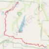
Cedar Falls from Old Man's Cave via Buckeye Trail in Hocking Hills State Park
United States > Ohio > Hocking County > Cedar Grove
The hike from Old Man's Cave to Cedar Falls offers a blend of stunning natural beauty and unique geological features. As you traverse the trail, you'll encounter the towering hemlocks, steep sandstone cliffs, and cascading waters of Cedar Falls, which is particularly impressive after rainfall. The…
Distance: 8.7 Km • Elevation gain: 141 m • Maximum elevation: 278 m
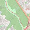
Twin Falls and Sculpture Falls along Austin's Barton Creek Greenbelt Trail
United States > Texas > Travis County > Austin
The Twin Falls and Sculpture Falls hike is a perfect blend of rugged adventure and natural beauty. This out-and-back trail takes you through shady, tree-covered paths, with rocky sections and boulders that make it fun and moderately challenging. The highlight is reaching the serene waterfalls—Twin Falls and…
Distance: 5.2 Km • Elevation gain: 59 m • Maximum elevation: 186 m
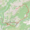
Half Dome
United States > California > Mariposa County > Curry Village
From Happy Isles, this demanding Yosemite route follows the Merced River into the forested canyon of the Mist Trail, passing the spray and granite stairways of Vernal Fall before continuing above the river toward Emerald Pool and the broader waterfall amphitheater around Nevada Fall. Beyond Nevada Fall, the…
Distance: 24.8 Km • Elevation gain: 1,983 m • Maximum elevation: 2,687 m
Tanyard Creek Park Loop
United States > Arkansas > Benton County > Bella Vista
The Tanyard Creek Park Loop offers a serene escape with its well-maintained paths that wind alongside a picturesque creek and through lush woodlands. Highlights of the route include a scenic waterfall and a charming wooden bridge, providing perfect spots for photographs and moments of reflection. Suitable for…
Distance: 3.0 Km • Elevation gain: 59 m • Maximum elevation: 326 m

Wissahickon Gorge North Loop in Wissahickon Valley Park
United States > Pennsylvania > Philadelphia County > Philadelphia
The Wissahickon Gorge North Loop offers a refreshing escape into nature, featuring a blend of wooded paths and rocky terrain along the scenic Wissahickon Creek. Hikers can enjoy stunning views, diverse birdlife, and historical landmarks, such as remnants of old mills and picturesque bridges. With its moderate…
Distance: 7.8 Km • Elevation gain: 214 m • Maximum elevation: 123 m

Audubon Park Loop in New Orleans
United States > Louisiana > Orleans Parish > New Orleans
Audubon Park Loop offers a serene escape within the city's vibrant atmosphere. As you stroll along the paved path, you’ll be surrounded by majestic live oak trees, tranquil lagoons, and picturesque bridges, making it an ideal spot for leisurely walks or invigorating runs. The loop is not only a scenic route…
Distance: 3.2 Km • Elevation gain: 5 m • Maximum elevation: 9 m

Skyline Trail Loop in Beavers Bend State Park
United States > Oklahoma > McCurtain County
The Skyline Trail is a challenging loop hike that rewards adventurous visitors with sweeping views of the surrounding Ouachita Mountains, lush forests, glimpses of the Mountain Fork River below and even a hidden waterfall nestled in the forest. The trail leads hikers through rocky paths, forested ridges, and…
Distance: 13.7 Km • Elevation gain: 450 m • Maximum elevation: 263 m
Lake Chabot Loop Trail in Lake Chabot Regional Park
United States > California > Alameda County > Castro Valley
The Lake Chabot Loop via West Shore Trail, Chabot Dam, Bass Cove Trail, Columbine Trail, Honker Bay Trail and East Shore Trail offers a scenic and varied hiking experience, weaving through shaded forests, sunny open trails, and peaceful lakeside paths. Hikers can enjoy sweeping views of Lake Chabot from…
Distance: 14.2 Km • Elevation gain: 464 m • Maximum elevation: 178 m

Morgan Lakes via Little Lakes Valley Trail and Morgan Pass in Inyo National Forest
United States > California > Inyo County
The hike to Morgan Lakes via the Little Lakes Valley Trail offers an unforgettable experience in the heart of the Eastern Sierra. Starting at Mosquito Flat, the trail weaves through a stunning landscape filled with serene alpine lakes like Mack Lake, Marsh Lake, Heart Lake and Box Lake, all framed by towering…
Distance: 7.4 Km • Elevation gain: 323 m • Maximum elevation: 3,382 m

South Kaibab - Tonto - Bright Angel (Grand Canyon)
United States > Arizona > Coconino County
From Yaki Point, the route commits at once to the exposed descent of the South Kaibab Trail, a dramatic ridgeline path known for wide, open views and very little shade or water. It first reaches Ooh Aah Point, where the canyon opens suddenly in every direction, then continues through the sculpted upper…
Distance: 30.1 Km • Elevation gain: 2,293 m • Maximum elevation: 2,217 m

Falls Trail and Highland Trail Loop in Ricketts Glen State Park
United States > Pennsylvania > Luzerne County > Fairmount Township
The Falls Trail and Highland Trail Loop at Ricketts Glen State Park is renowned for its breathtaking array of waterfalls, with hikers encountering a stunning collection of 21 named falls along the route such as the impressive Ganoga Falls and the serene F.L. Ricketts Falls. The trail meanders through lush…
Distance: 7.0 Km • Elevation gain: 262 m • Maximum elevation: 686 m

Suffolk Coast Path (SCP) between Hopton and Lowestoft
United Kingdom > England > Suffolk > East Suffolk > Corton
Distance: 19.9 Km • Elevation gain: 139 m • Maximum elevation: 30 m
Beaver Lodge Nature Trail along Mountain Fork River in Beavers Bend State Park
United States > Oklahoma > McCurtain County > Stephens Gap
The Beaver Lodge Nature Trail offers a delightful escape into nature, winding along the beautiful Mountain Fork River. Hikers will appreciate the tranquil sounds of rushing water and the vibrant scenery, including a stunning waterfall that serves as a focal point of the route. This accessible trail, known for…
Distance: 4.8 Km • Elevation gain: 97 m • Maximum elevation: 187 m
Mount Mansfield Loop via Maple Ridge Trail, Long Trail and Sunset Ridge Trail
United States > Vermont > Chittenden County > Underhill
The Mount Mansfield Loop provides a challenging but rewarding hike to the highest peak in Vermont. As you climb, the varied terrain offers rocky paths, steep ascents, and exposed ridgelines, culminating in breathtaking panoramic views of the Champlain Valley, the Adirondacks, and the Green Mountains. The…
Distance: 13.2 Km • Elevation gain: 884 m • Maximum elevation: 1,332 m
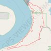
Macbride Waterfall and Coralville Lake Loop in Macbride Nature and Recreation Area
United States > Iowa > Johnson County > Solon
The Macbride Waterfall and Coralville Lake Loop offers a scenic and varied hike that weaves through forested paths and along the shores of Coralville Lake. With views of the lake nearly always in sight, the trail offers both quiet wooded sections and open stretches near the water, making it ideal for spotting…
Distance: 3.3 Km • Elevation gain: 66 m • Maximum elevation: 250 m

Hollywood Sign via Innsdale Trail and Mount Lee Drive in Griffith Park
United States > California > Los Angeles County > Los Angeles
The hike to the Hollywood Sign via Innsdale Trail and Mount Lee Drive offers an up-close experience with this iconic landmark, providing panoramic views of Los Angeles, the expansive Lake Hollywood Reservoir and the surrounding hills and valleys. Along the way, hikers can enjoy the natural beauty of Griffith…
Distance: 7.0 Km • Elevation gain: 298 m • Maximum elevation: 497 m
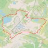
Chain Lakes Loop Trail
United States > Washington > Whatcom County
The Chain Lakes Loop Trail explores the dramatic alpine landscape of the Mount Baker–Snoqualmie National Forest, beginning here at Artist Point beneath the steep southern slopes of Table Mountain. The trail initially traverses open heather meadows and rocky terrain, with broad views toward Mount Baker, Mount…
Distance: 9.1 Km • Elevation gain: 601 m • Maximum elevation: 1,668 m
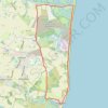
Eastbridge to Thorpeness loop hike - Suffolk Coast Path (SCP)
United Kingdom > England > Suffolk > East Suffolk > Leiston
Distance: 17.8 Km • Elevation gain: 84 m • Maximum elevation: 19 m
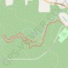
Friends Loop Trail in Beavers Bend State Park
United States > Oklahoma > McCurtain County > Stephens Gap
The Friends Trail is a moderately challenging loop hike that showcases the region’s natural beauty with captivating views of the Mountain Fork River and Broken Bow Lake. As hikers traverse the rugged path, they’re met with steep forested inclines and rocky stretches that offer glimpses of cascading…
Distance: 2.5 Km • Elevation gain: 82 m • Maximum elevation: 213 m
Wildcat Lake and Hemlock Hill Loop
United States > North Carolina > Avery County > Banner Elk
Starting in Banner Elk, the loop heads out through town to Mill Pond, where calm water and a pleasant valley setting introduce the walk before the route turns toward the grounds of Lees-McRae College. From there, the itinerary continues across the college area and down to Wildcat Lake, a scenic lakeside…
Distance: 7.5 Km • Elevation gain: 209 m • Maximum elevation: 1,180 m

Canopy, Lost and Fern Creek Trails Loop in Muir Woods National Monument
United States > California > Marin County
The Canopy, Lost, and Fern Creek Trails Loop in Muir Woods National Monument offers hikers a serene journey through towering redwoods, lush fern-lined paths, and tranquil creek crossings. The trail ascends gently, providing elevated views of the forest canopy, and descends alongside the picturesque Fern Creek,…
Distance: 4.9 Km • Elevation gain: 262 m • Maximum elevation: 224 m

Blue Heron Lake Loop via Raccoon River Park Trail
United States > Iowa > Polk County > West Des Moines
The Blue Heron Lake Loop offers a peaceful, scenic hike around a lake, featuring views of both water and wetlands. With mostly flat terrain and sections of the path shaded by trees, it’s a popular spot for hikers, joggers, and families, providing accessibility for people of all skill levels. Along the route,…
Distance: 5.0 Km • Elevation gain: 17 m • Maximum elevation: 251 m

Beehive Trail, Gorham Mountain Trail and Ocean Path Loop in Acadia National Park
United States > Maine > Hancock County > Bar Harbor
The Beehive Trail, Gorham Mountain Trail, and Ocean Path Loop in Acadia National Park offer a diverse and rewarding hiking experience. Starting with the Beehive Trail, hikers ascend a steep path equipped with iron rungs, leading to panoramic views of Sand Beach and the surrounding coastline. Continuing along…
Distance: 6.0 Km • Elevation gain: 248 m • Maximum elevation: 150 m

Indian Garden (Grand Canyon)
United States > Arizona > Coconino County > Grand Canyon Village
From Grand Canyon Village on the South Rim, the route drops onto the Bright Angel Trail, passing the rim-side trailhead, the upper tunnel, Mallery’s Grotto pictographs, and the second tunnel as the path enters a shaded side canyon framed by high cliffs. The descent continues through long switchbacks and…
Distance: 7.5 Km • Elevation gain: 339 m • Maximum elevation: 2,085 m

Bicycle journey from Carmarthen to Ffairfach and back, on the Tywi Valley Path
United Kingdom > Wales > Carmarthenshire > Carmarthen
Distance: 51.3 Km • Elevation gain: 349 m • Maximum elevation: 43 m

1.5 Mile Resthouse (Grand Canyon)
United States > Arizona > Coconino County > Grand Canyon Village
From Grand Canyon Village, the route leaves the rim near Bright Angel Lodge and drops onto the Bright Angel Trail, quickly entering the shaded upper canyon through tight switchbacks and broad South Rim viewpoints. The path continues across pale cliffs, wooded pockets and exposed canyon slopes, following one of…
Distance: 2.6 Km • Elevation gain: 192 m • Maximum elevation: 2,085 m

Balanced Rock and Devil's Doorway Loop via Balanced Rock Trail, East Bluff Trail, Devil's Doorway Trail, Potholes Trail and Grottos Trail in Devil's Lake State Park
United States > Wisconsin > Sauk County
The Balanced Rock and Devil's Doorway Loop offers a unique blend of breathtaking vistas and challenging terrain, rewarding hikers with views of the lake and surrounding bluffs. The route includes steep stone steps along the Balanced Rock Trail, ascending through dense pine forest to views of Devil's Lake, with…
Distance: 2.3 Km • Elevation gain: 150 m • Maximum elevation: 433 m

Double Arch Loop via Auxier Ridge, Haystack Rock and Courthouse Rock
United States > Kentucky > Powell County
The Double Arch Loop offers hikers a memorable journey through some of the region's most striking natural features. As you traverse the Auxier Ridge, expect to be treated to sweeping views of the Red River Gorge, with expansive vistas over rocky outcrops, lush valleys, and iconic rock formations like Double…
Distance: 10.0 Km • Elevation gain: 307 m • Maximum elevation: 395 m

Cathedral Rock Trail via Baldwin Trail and Templeton Trail in Coconino National Forest
United States > Arizona > Yavapai County > Baldwins Crossing
The Cathedral Rock Trail via Baldwin and Templeton Trails offers a peaceful and scenic approach to one of Sedona’s most iconic landmarks. Hikers follow a path lined with red rock formations, pinyon pines, and junipers, with occasional views of Oak Creek's lush greenery adding contrast to the desert…
Distance: 6.1 Km • Elevation gain: 275 m • Maximum elevation: 1,439 m

National Mall Loop
This loop walk is a scenic and enriching journey through Washington DC's most iconic landmarks. As you walk along the broad, tree-lined pathways, you'll encounter historic sites such as the Lincoln Memorial, the Washington Monument, and the Capitol Building, with numerous museums and memorials lining the way.…
Distance: 7.9 Km • Elevation gain: 68 m • Maximum elevation: 16 m

Lovers' Leap Trail in Custer State Park
United States > South Dakota > Custer County > State Game Lodge
Lovers' Leap loop trail offers a delightful mix of scenery, starting with a climb through towering ponderosa pines and leading to sweeping views of the Black Hills. The rocky outcrop at the top provides breathtaking panoramas, including views of Mount Coolidge and Black Elk Peak, making the initial uphill…
Distance: 6.9 Km • Elevation gain: 225 m • Maximum elevation: 1,427 m
Loop hike at Deadmans Hill via Jordan Valley Pathway in Mackinaw State Forest
United States > Michigan > Antrim County > Warner Township
Distance: 11.9 Km • Elevation gain: 235 m • Maximum elevation: 401 m
Patriot's Park Loop
United States > Georgia > Columbia County
Starting at Patriot’s Park in Grovetown, this loop begins among recreation fields, ponds, and wooded park edges before joining the Bartram Bike and Walk Trail for a first circuit around the Bartram Trail neighborhood, its residential green spaces, and the golf-course landscape. It then connects with the…
Distance: 21.0 Km • Elevation gain: 224 m • Maximum elevation: 128 m

Grand Canyon Rim Trail from Mather Point to Bright Angel Trailhead
United States > Arizona > Coconino County
The Grand Canyon Rim Trail from Mather Point to the Bright Angel Trailhead offers hikers a leisurely walk along the South Rim, showcasing expansive vistas of the canyon's intricate rock formations and the meandering Colorado River below. Along the route, notable viewpoints such as Yavapai Point provide…
Distance: 10.1 Km • Elevation gain: 450 m • Maximum elevation: 2,180 m

Twin Falls and Sculpture Falls via Barton Creek Greenbelt Trail
United States > Texas > Travis County > Austin
The Barton Creek Greenbelt Trail offers a serene escape just minutes from downtown Austin. The path weaves through lush woods and alongside the creek, revealing scenic waterfalls such as the popular Twin Falls and the more secluded Sculpture Falls. While the terrain features occasional rocky sections, it’s…
Distance: 5.4 Km • Elevation gain: 69 m • Maximum elevation: 186 m

Sawmill Reservoir Loop
United States > Colorado > Summit County > Breckenridge
The Sawmill Reservoir Loop in Breckenridge offers a peaceful and scenic hike, ideal for visitors seeking a short, accessible route near the town. As you traverse the well-maintained path, you'll enjoy views of the tranquil reservoir, surrounded by towering pines and open meadows, with occasional glimpses of…
Distance: 2.1 Km • Elevation gain: 71 m • Maximum elevation: 3,033 m

Hemlock Falls Loop
United States > New Jersey > Essex County > Maplewood
Starting from the South Orange Avenue access, this loop enters South Mountain Reservation on the Crest Trail and follows a shaded woodland corridor before joining Openwood Trail and curving deeper into the forest. The route then uses Lenape Trail and the local Hemlock Falls Loop to reach Hemlock Falls on…
Distance: 2.6 Km • Elevation gain: 67 m • Maximum elevation: 163 m

Path of the Gods | Sentiero degli Dei: Bomerano - Positano
Italy > Campania > Naples > Bomerano
Distance: 8.3 Km • Elevation gain: 616 m • Maximum elevation: 652 m

East Coast Trail - Sugarloaf Path
Canada > Newfoundland and Labrador > Logy Bay-Middle Cove-Outer Cove
#Hiking #Newfoundland #Atlantic
Distance: 8.4 Km • Elevation gain: 447 m • Maximum elevation: 154 m

Dames Cave, Peace Cave and Lizzie Heart Sink Loop
United States > Florida > Citrus County
This loop in Withlacoochee State Forest offers hikers a captivating mix of geological wonders and natural beauty. Along the trail, you’ll encounter limestone caves, like Dames Cave, which showcase intricate rock formations and provide an intriguing glimpse into Florida’s karst topography. The path also…
Distance: 6.5 Km • Elevation gain: 55 m • Maximum elevation: 35 m

Noccalula Falls and Gorge Loop Trail via Black Creek Trail in Noccalula Falls Park
United States > Alabama > Etowah County > Gadsden
The Noccalula Falls and Gorge Loop Trail offers a scenic mix of forested paths, rocky terrain, and breathtaking views of Noccalula Falls cascading into the gorge below. Hikers are drawn to the unique perspective offered by trails that pass beneath the falls and by a suspension bridge spanning the creek, giving…
Distance: 3.2 Km • Elevation gain: 71 m • Maximum elevation: 216 m
Oberg Mountain Loop Trail in Superior National Forest
United States > Minnesota > Cook County
The Oberg Mountain Loop Trail is a rewarding hike, offering breathtaking views of the surrounding forest, lakes, and distant mountains. Along the trail, you’ll experience several scenic overlooks that provide sweeping vistas of the blue expanse of Lake Superior, the rugged Sawtooth Mountains, and the dense,…
Distance: 3.7 Km • Elevation gain: 180 m • Maximum elevation: 462 m
The Wave Trail in Vermilion Cliffs National Monument
United States > Utah > Kane County
The Wave Trail in Vermilion Cliffs National Monument offers hikers a journey through a landscape of undulating sandstone formations, vibrant red and orange hues, and expansive vistas of the surrounding desert terrain. The path meanders across varied terrains, including sandy stretches and smooth rock surfaces,…
Distance: 9.0 Km • Elevation gain: 288 m • Maximum elevation: 1,588 m

3 Mile Resthouse (Grand Canyon)
United States > Arizona > Coconino County > Grand Canyon Village
From Grand Canyon Village, the route leaves the South Rim at the Bright Angel Trailhead near the historic rim area and drops onto the Bright Angel Trail, one of the park’s classic corridor trails, used through time by Indigenous peoples, miners, early tourists, hikers, and mule parties. The descent quickly…
Distance: 4.8 Km • Elevation gain: 262 m • Maximum elevation: 2,085 m

Delicate Arch
United States > Utah > Grand County
Starting at the Delicate Arch Trailhead, the route leaves the parking area near Salt Wash and follows Delicate Arch Trail past the historic Wolfe Ranch area and the nearby Ute Indian petroglyph panel. From there, it heads into open desert terrain, crossing shallow drainages and moving away from the easier…
Distance: 5.1 Km • Elevation gain: 194 m • Maximum elevation: 1,469 m
Mount Moosilauke Loop in White Mountain National Forest
United States > New Hampshire > Grafton County > Woodstock
Embarking on the Mount Moosilauke Loop via the Gorge Brook Trail, Carriage Road, and South Peak offers hikers a journey through diverse terrains, from serene forested paths alongside Gorge Brook to the expansive, open summit of Mount Moosilauke. The treeless peak provides panoramic views of the surrounding…
Distance: 11.5 Km • Elevation gain: 733 m • Maximum elevation: 1,457 m
Lost Valley Trail to Eden Falls and Cob Cave in Buffalo National River
United States > Arkansas > Newton County > Beechwood
The Lost Valley Trail offers a captivating hike that showcases a variety of natural wonders. As you traverse the path, you’ll encounter a stunning natural bridge and the picturesque Eden Falls, which flows beautifully during wet seasons. The trail also leads to Cob Cave, where you can explore a historical…
Distance: 3.8 Km • Elevation gain: 123 m • Maximum elevation: 440 m
Mount Joy Trail, Horse-Shoe Trail and Mount Misery Trail Loop in Valley Forge National Historical Park
United States > Pennsylvania > Chester County > Tredyffrin Township > Chesterbrook
The loop combining the Mount Joy Trail, Horse-Shoe Trail, and Mount Misery Trail presents a delightful blend of natural beauty and historical significance. Hikers can expect to traverse wooded paths that offer serene views, including glimpses of the Schuylkill River and historical landmarks such as the Knox…
Distance: 6.7 Km • Elevation gain: 247 m • Maximum elevation: 147 m

Norfolk Coast Path - Cley to Cromer
United Kingdom > England > Norfolk > North Norfolk > Cley next the Sea
norfolk-coast-path, cley-next-the-sea, weybourne, sheringham, west-runton, east-runton, cromer
Distance: 20.1 Km • Elevation gain: 282 m • Maximum elevation: 43 m

Little Big Econ State Forest Loop
United States > Florida > Seminole County
This loop enters Little Big Econ State Forest on the Barr Street Trail, then follows the Florida Trail through humid subtropical woodland toward the Econlockhatchee River. The route continues beside the river corridor, where sandy banks, low bluffs, floodplain forest, and quiet wetland views shape the main…
Distance: 9.4 Km • Elevation gain: 15 m • Maximum elevation: 11 m

South Loop of City Park in New Orleans
United States > Louisiana > Orleans Parish > New Orleans
The South Loop of City Park offers a refreshing hiking experience through lush landscapes dotted with ancient oak trees and vibrant gardens. As you walk, you can enjoy views of serene lagoons, sculptures from the Sydney and Walda Besthoff Sculpture Garden, and the diverse wildlife that inhabits the area. This…
Distance: 5.8 Km • Elevation gain: 4 m • Maximum elevation: 5 m

Cedar Bluff Nature Loop Trail in Beavers Bend State Park
United States > Oklahoma > McCurtain County
The Cedar Bluff Nature Loop Trail in Beavers Bend State Park provides a delightful hiking experience, showcasing the lush landscapes and diverse wildlife of the area. As you traverse the well-marked path, you'll encounter towering trees, vibrant flora, and the soothing sounds of nearby streams, all…
Distance: 1.4 Km • Elevation gain: 41 m • Maximum elevation: 165 m

Paoli via Southwest Bike Path, Badger State Trail and Military Ridge State Trail
United States > Wisconsin > Dane County > Madison
Distance: 43.3 Km • Elevation gain: 288 m • Maximum elevation: 323 m

Ottawa River Pathway
Distance: 21.6 Km • Elevation gain: 130 m • Maximum elevation: 80 m

Seven Bridges Trail
United States > Colorado > El Paso County
From the upper North Cheyenne Cañon access area, the route first follows Gold Camp Road through a wooded canyon setting before joining Seven Bridges Trail, a popular path known for tracing North Cheyenne Creek. The itinerary then moves upstream beside the creek, entering denser forest and passing its…
Distance: 5.7 Km • Elevation gain: 287 m • Maximum elevation: 2,575 m

Eliot Tower and Great Blue Hill Loop via Skyline Trail in Blue Hills Reservation
United States > Massachusetts > Norfolk County > Milton
The Eliot Tower and Great Blue Hill Loop offers hikers a rewarding blend of natural beauty and historical significance. As you traverse the rocky terrain, you’ll encounter stunning panoramic views of the Boston skyline and the surrounding landscape from the summit of Great Blue Hill, making it an ideal spot…
Distance: 5.4 Km • Elevation gain: 226 m • Maximum elevation: 187 m

Mount Greylock
United States > Massachusetts > Berkshire County > Adams
From the Greylock Glen trailhead, the hike first follows the Glen Meadow Loop through open meadow, wetland edges and woodland, with Mount Greylock rising ahead as the route leaves the gentler Glen paths for the Bellows Pipe approach. The climb then moves into denser forest on Bellows Pipe and toward the…
Distance: 8.9 Km • Elevation gain: 729 m • Maximum elevation: 1,062 m

Myra-Bellevue Park hiking trails
Canada > British Columbia > Regional District of Central Okanagan > Kelowna
foot, hike, path, loop
Distance: 12.5 Km • Elevation gain: 474 m • Maximum elevation: 944 m
Zorinsky Lake Loop Trail in Omaha
United States > Nebraska > Douglas County > Omaha
The Zorinsky Lake Loop Trail offers a peaceful experience for hikers and cyclists, with much of the route running along the water's edge. You’ll encounter scenic views of the lake and occasional shaded stretches through wooded areas, particularly near Boxelder Creek. The well-maintained path provides a…
Distance: 11.6 Km • Elevation gain: 100 m • Maximum elevation: 351 m
Wyandotte County Lake Bridle Loop Trail
United States > Kansas > Wyandotte County > Kansas City > Vinewood
The Wyandotte County Lake Bridle Loop Trail offers a refreshing outdoor experience with picturesque views of the lake and surrounding woodlands. As you hike, you'll encounter diverse wildlife, particularly a variety of birds, and the trail's peaceful ambiance is perfect for both solo explorers and families.…
Distance: 17.1 Km • Elevation gain: 332 m • Maximum elevation: 295 m
Mount Rubidoux
United States > California > Riverside County > Riverside
From the Glenwood Drive entrance, the loop follows Mount Rubidoux’s paved park road through open, boulder-strewn slopes above the Santa Ana River. It climbs past the Peace Tower and Friendship Bridge to the summit area, where the Serra Cross, flag, historic plaques, and broad Riverside views form the…
Distance: 4.8 Km • Elevation gain: 177 m • Maximum elevation: 391 m
Swallow Falls Canyon Loop Trail in Swallow Falls State Park
United States > Maryland > Garrett County
The Swallow Falls Canyon Loop Trail offers a scenic, moderately easy hike through an area known for its lush forests and beautiful waterfalls. As you walk, you'll pass by the majestic Muddy Creek Falls, which is Maryland’s tallest waterfall, along with Swallow Falls, Lower Swallow Falls, and Tolliver Falls.…
Distance: 1.9 Km • Elevation gain: 46 m • Maximum elevation: 725 m
Old Mine, Dipsea and Steep Ravine Trails Loop in Mount Tamalpais State Park
United States > California > Marin County
The Old Mine, Dipsea, and Steep Ravine Trails Loop in Mount Tamalpais State Park offers hikers a diverse experience, featuring towering redwood forests, cascading waterfalls, and panoramic views of the Pacific Ocean. Along the route, one can traverse lush fern-lined paths, navigate wooden ladders beside Webb…
Distance: 6.2 Km • Elevation gain: 310 m • Maximum elevation: 459 m

Oyster Dome Trail in Blanchard State Forest
United States > Washington > Skagit County > Samish
The Oyster Dome Trail, accessed via Chuckanut Drive and the Samish Bay Connector, offers hikers a rewarding journey through Blanchard State Forest. The path meanders through lush forests of alder, cedar, and Douglas fir, with occasional views of the Salish Sea and the Olympic Peninsula. The trail culminates at…
Distance: 10.8 Km • Elevation gain: 614 m • Maximum elevation: 607 m

Little Haystack Mountain, Mount Lincoln and Mount Lafayette Loop
United States > New Hampshire > Grafton County > Lincoln
Loop hike from Franconia Notch via Falling Waters Trail, Stairs Falls, Swiftwater Falls, Cloudland Falls, Little Haystack Mountain, Franconia Ridge Trail, Mount Lincoln, Mount Lafayette, Greenleaf Trail, Greenleaf Hut and Old Bridle Path in the Franconia Notch State Park and the White Mountain National Forest.…
Distance: 13.1 Km • Elevation gain: 1,146 m • Maximum elevation: 1,582 m
Black Spout Wood to West Haugh
United Kingdom > Scotland > Perth and Kinross > Pitlochry > Westhaugh of Dalshian
Distance: 2.8 Km • Elevation gain: 82 m • Maximum elevation: 132 m

Boulder Gorge Loop Trail in Schooley's Mountain County Park
United States > New Jersey > Morris County > Washington Township > Long Valley > Naughright
The Boulder Gorge Loop Trail offers a refreshing hike through New Jersey’s lush woodlands, leading past cascading waterfalls, rugged rock formations, and Lake George. The trail provides a scenic mix of forested paths and rocky sections that meander along Electric Brook, with viewpoints overlooking the gorge…
Distance: 3.8 Km • Elevation gain: 173 m • Maximum elevation: 325 m

Coyote Song Trail and Swallow Trail Loop in South Valley Park
United States > Colorado > Jefferson County
The Coyote Song and Swallow Trail Loop at South Valley Park offers a peaceful escape through meadows and striking red rock formations, typical of Colorado's Front Range. Hikers will enjoy expansive views of rolling hills and nearby foothills while traversing a mostly level, well-maintained path. It's an easy…
Distance: 4.6 Km • Elevation gain: 105 m • Maximum elevation: 1,836 m

Nymph Lake, Dream Lake and Emerald Lake via Emerald Lake Trail
United States > Colorado > Larimer County
The hike along the Emerald Lake Trail in Rocky Mountain National Park offers a delightful progression through stunning alpine scenery. Starting at Nymph Lake, hikers are greeted with a peaceful, forest-framed setting, where reflections of towering peaks can be seen in the calm waters. The path then leads to…
Distance: 5.0 Km • Elevation gain: 204 m • Maximum elevation: 3,094 m

Vernal Fall and Clark Point loop via John Muir Trail and Mist Trail Trail in Yosemite National Park
United States > California > Mariposa County > Curry Village
The Vernal Fall and Clark Point loop is a strenuous yet rewarding hike through the heart of Yosemite’s beauty. The journey takes you up steep steps alongside Vernal Fall, before leading to sweeping views of the valley from Clark Point. Though challenging, the mix of waterfalls, granite cliffs, and forested…
Distance: 8.0 Km • Elevation gain: 730 m • Maximum elevation: 1,703 m
River Almond riverside paths
United Kingdom > Scotland > West Lothian > Livingston
Distance: 4.8 Km • Elevation gain: 34 m • Maximum elevation: 113 m
Trading Post Trail in Red Rocks Park
United States > Colorado > Jefferson County
The Trading Post Trail in Red Rocks Park is a delightful loop that showcases the park's breathtaking red rock formations and offers sweeping views of the surrounding landscapes. As you meander along this well-maintained path, you’ll encounter several sets of stairs that add a fun challenge, all while being…
Distance: 2.5 Km • Elevation gain: 110 m • Maximum elevation: 1,913 m

Parramatta Valley Cycleway and Parramatta Park Loop Ride
Australia > New South Wales > Sydney
The Parramatta Valley Cycleway and Parramatta Park Loop Ride offer a delightful escape into nature, winding alongside the picturesque Parramatta River. You'll encounter stunning views of the river, charming heritage sites like Old Government House, and the lush greenery of Parramatta Park, making it a perfect…
Distance: 31.8 Km • Elevation gain: 273 m • Maximum elevation: 32 m

Ocean Path Trail in Acadia National Park
United States > Maine > Hancock County > Bar Harbor
The Ocean Path Trail in Acadia National Park offers hikers a picturesque journey along Maine's rugged coastline, beginning at Sand Beach and culminating at Otter Point. Along this mostly level trail, you'll encounter notable landmarks such as Thunder Hole, where waves crash into a narrow inlet creating…
Distance: 6.8 Km • Elevation gain: 152 m • Maximum elevation: 33 m
Florida Trail from Lockwood Road to Barr Street in Little Big Econ State Forest
United States > Florida > Seminole County > Oviedo
This Florida Trail section offers a tranquil and diverse hiking experience. Hikers will encounter boardwalks crossing small creeks, as well as sections that skirt the serene shores of the Econlockhatchee River, providing scenic views of the surrounding cypress trees and oak hammocks. The trail offers a…
Distance: 9.3 Km • Elevation gain: 19 m • Maximum elevation: 14 m

Lonesome Lake Loop Trail in Franconia Notch State Park
United States > New Hampshire > Grafton County > Lincoln
The Lonesome Lake Loop Trail offers hikers a scenic escape, winding through dense forests and eventually opening up to serene lake views framed by the rugged peaks of Franconia Ridge. As you hike around the lake, boardwalks cross wetland areas, and the calming sounds of nature create a peaceful ambiance, with…
Distance: 5.0 Km • Elevation gain: 309 m • Maximum elevation: 840 m
Cairngorm Hill Track - Gravel Ride
United Kingdom > Scotland > Highland
Distance: 6.5 Km • Elevation gain: 465 m • Maximum elevation: 1,092 m
Suffolk Coast Path #05 (Dunwich to Eastbridge)
United Kingdom > England > Suffolk > East Suffolk > Middleton > Fordley
Distance: 17.5 Km • Elevation gain: 133 m • Maximum elevation: 27 m
Paths around Milngavie Golf Club
United Kingdom > Scotland > East Dunbartonshire > Milngavie
Distance: 2.0 Km • Elevation gain: 27 m • Maximum elevation: 88 m

Loop hike via The Beehive, The Bowl, Gorham Mountain and Ocean Path in Acadia National Park
United States > Maine > Hancock County > Bar Harbor
Thi loop hike presents an engaging mix of challenging climbs and stunning vistas. Starting with the steep ascent of The Beehive, hikers are treated to breathtaking views of the Atlantic Ocean and surrounding landscapes, making the effort worthwhile. As the trail meanders down to The Bowl—a serene, reflective…
Distance: 5.8 Km • Elevation gain: 239 m • Maximum elevation: 150 m

Preacher's Rock from Woody Gap via Appalachian Trail in Blood Mountain Wilderness
United States > Georgia > Lumpkin County
The hike to Preacher's Rock is a moderately challenging trek that offers an impressive payoff with its expansive views. Along the route, hikers will encounter rocky terrain, root-laden paths, and sharp switchbacks as they ascend towards the summit of Big Cedar Mountain. At Preacher's Rock, the view stretches…
Distance: 3.2 Km • Elevation gain: 136 m • Maximum elevation: 1,074 m

Green River Bluffs Trail, Echo River Springs Trail, Sinkhole Trail and Heritage Trail Loop
United States > Kentucky > Edmonson County
This loop in Mammoth Cave National Park offer a diverse range of outdoor experiences, showcasing Kentucky’s unique geological features. Hikers can expect to see sweeping views of the Green River and its surrounding bluffs, sinkholes, and natural springs, while walking through shaded woodlands, past limestone…
Distance: 6.7 Km • Elevation gain: 207 m • Maximum elevation: 238 m
Clausland Mountain trails
United States > New York > Rockland County > Blauvelt
Distance: 10.1 Km • Elevation gain: 279 m • Maximum elevation: 201 m

Bronx River Pathway
United States > New York > Westchester County > City of Yonkers
Distance: 22.2 Km • Elevation gain: 154 m • Maximum elevation: 56 m
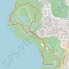
John Chesnut Sr. Park Loop Trail
United States > Florida > Pinellas County > East Lake
The John Chesnut Sr. Park Loop Trail offers a scenic and tranquil experience, winding through lush floodplain forests, cypress swamps, and wetlands. Along the path, hikers can enjoy views of Lake Tarpon, observe local wildlife like herons and alligators, and explore boardwalks that traverse marshy areas. The…
Distance: 4.5 Km • Elevation gain: 26 m • Maximum elevation: 11 m
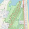
Prickly Pear Loop Trail in Delaware Seashore State Park Fresh Pond
United States > Delaware > Sussex County
The Prickly Pear Loop Trail offers a delightful experience for nature enthusiasts seeking tranquility. As you traverse this scenic route, you’ll encounter diverse habitats, including coastal wetlands and woodlands, providing ample opportunities to spot local wildlife such as deer and various bird species.…
Distance: 5.7 Km • Elevation gain: 14 m • Maximum elevation: 4 m

Turkey Mountain Loop via Yellow Trail in Turkey Mountain Urban Wilderness Area
United States > Oklahoma > Tulsa County > Tulsa
The Turkey Mountain Loop via the Yellow Trail offers a moderately challenging hike through Tulsa’s natural landscapes, complete with forested paths, rocky stretches, and scenic overlooks of the Arkansas River. This loop winds through diverse terrain, providing a rewarding mix of tranquility and rugged…
Distance: 6.4 Km • Elevation gain: 124 m • Maximum elevation: 275 m
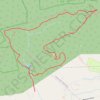
Pulpit Rock, The Pinnacle and Hamburg Reservoir Loop
United States > Pennsylvania > Berks County > Windsor Township > Edenburg
This loop trail offers a memorable hike through Pennsylvania's scenic landscape. The trail provides sweeping views from the dramatic outcrops of Pulpit Rock and The Pinnacle, where hikers can enjoy vistas of the Lehigh Valley and nearby rolling hills. Along the way, the trail winds through varied terrain, from…
Distance: 14.9 Km • Elevation gain: 407 m • Maximum elevation: 491 m

Lincoln Woods Loop Trail in Lincoln Woods State Park
United States > Rhode Island > Providence County > Lincoln
The Lincoln Woods Loop Trail offers an inviting and scenic walk through a mix of dense woodlands and serene lakeside views, ideal for a leisurely outing in nature. Hikers can enjoy the calming presence of Olney Pond, glimpses of small wildlife, and the peaceful forest canopy that provides welcome shade along…
Distance: 5.3 Km • Elevation gain: 83 m • Maximum elevation: 89 m
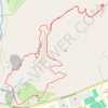
Sleeping Giant Loop via Blue Trail and Tower Path
United States > Connecticut > South Central Connecticut Planning Region > Hamden
This Sleeping Giant Loop offers a fantastic blend of scenic vistas and engaging terrain. As hikers ascend, they are treated to breathtaking views from various overlooks, where on clear days, the expanse stretches all the way to Long Island Sound. The trail features rocky scrambles that add a thrilling element…
Distance: 5.1 Km • Elevation gain: 234 m • Maximum elevation: 215 m